CPS had released maps only a day before the shooting indicating certain streets that would be designated as Safe Passage Routes for students and parents to travel safely to their new Welcoming Schools. After 50 schools closed at the end of the Spring 2013 semester, a variety of Chicago residents raised the concern that in order to attend an operational school, students would have to commute through distressed neighborhoods and possibly gang territory. Geographic data exists that may shed light on this issue but, unsurprisingly, it is not without controversy.
There are a lot of criticisms about the meaningfulness of trying to map gang territory. No one knows exactly which blocks belong to which gangs at any given time and the situation can change quickly. But likely the most recent and most thorough effort carried out in Chicago is The Gang Book compiled by the Chicago Crime Commission. Nearly a year ago, WBEZ reporter, Elliott Ramos, painstakingly entered data from The Gang Book 2011 edition from it's original hardbound version into a digital map and published this article about it.
Overlaying gang territories with closed schools, Welcoming Schools, and Safe Passage Routes reveals that a lot of students might pass through gang territory on their way to their new schools this fall:

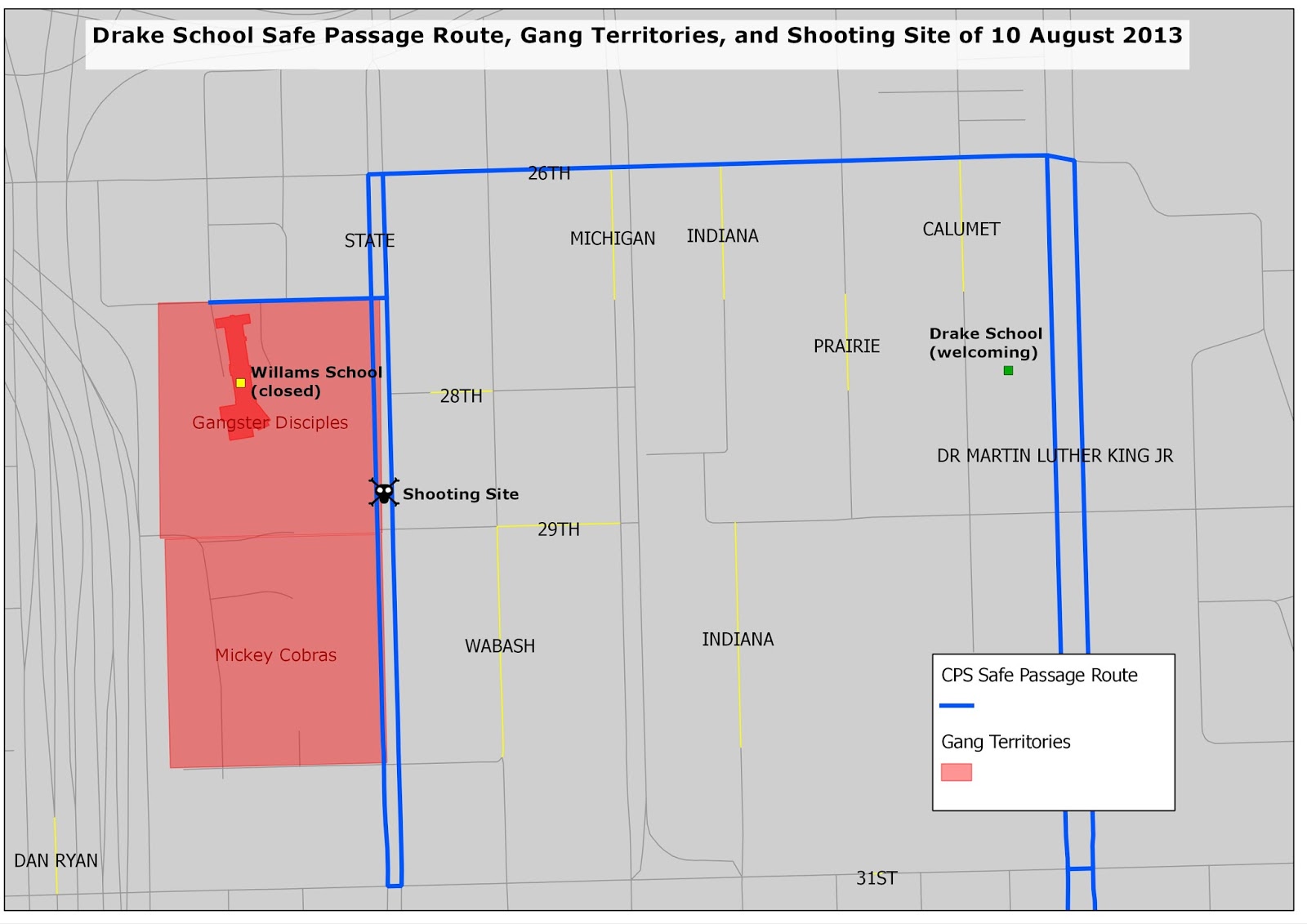
Zooming into the Drake School Safe Passage Route along which the recent shooting took place reveals that the site also lies on the boundary of territory controlled by the Gangster Disciples and close to territory controlled by the Mickey Cobras. The Safe Passage Route runs along their boundary for roughly three blocks:
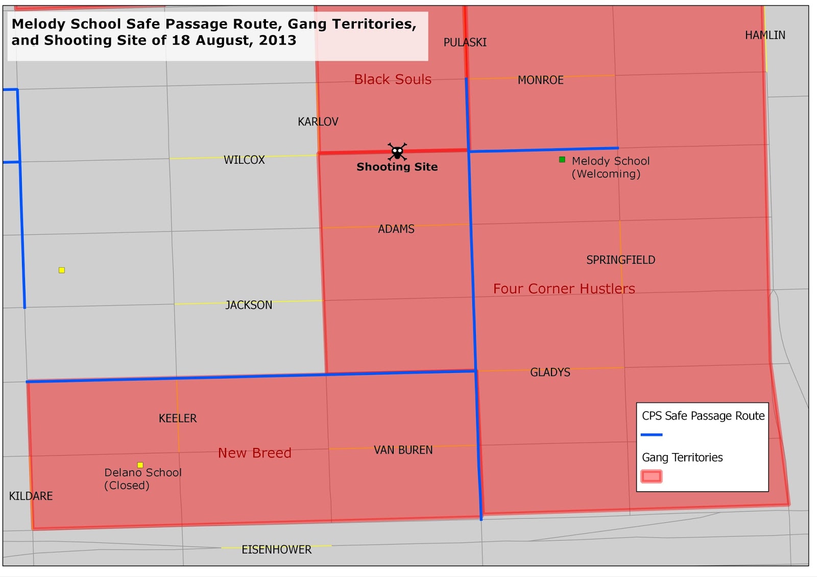
Roughly a week later, just after midnight the morning of Sunday, August 18th a 14-year-old boy was shot to death; this time in the West Garfield Park Community Area, along the 4000 block of West Wilcox Street, within a block of Melody School. Completely encompassing both the shooting site and the Melody School Safe Passage Route are the territories of the gangs Black Souls, New Breed, and Four Corner Hustlers.
With gang territory overlapping so many Safe Passage Routes, authorities might have their work cut out for them keeping students safe. So far there have not been any shootings to take place during school hours.